
Highlight Property Features
Show pools, outdoor living areas, outbuildings, acreage, driveways, and the relationship between structures.
FAA-compliant aerial media
Professional aerial photos and video that show property features, lot size, layout, location, and the surrounding community from a perspective ground-level images cannot provide.
Trusted by Realtors across Cypress, The Woodlands, Spring, and surrounding Greater Houston communities.
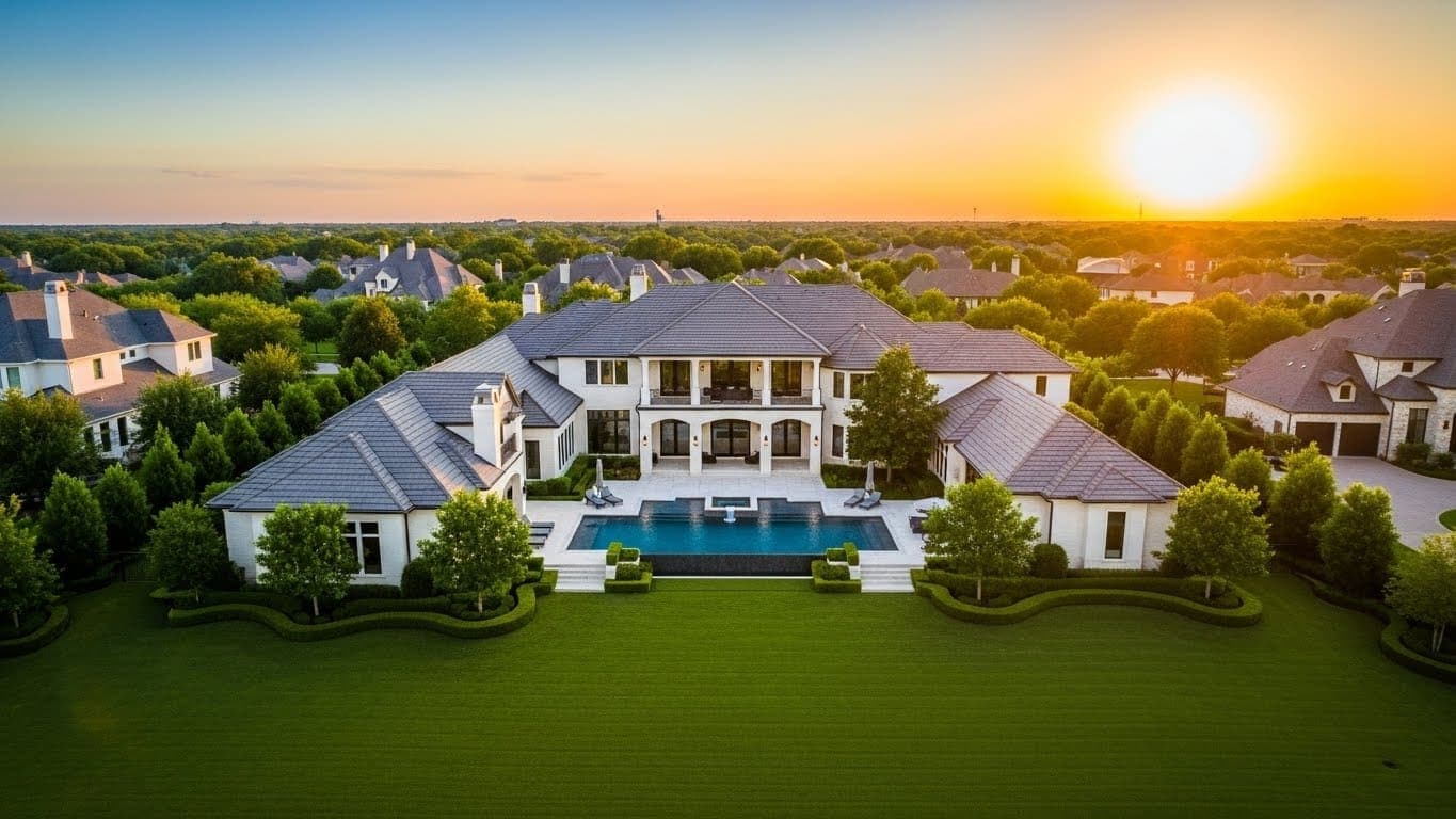
Aerial photos
From $125
Standard set
5 edited images
Easy booking
Monday-Saturday, 9 AM-5 PM
Next-day delivery
Because timing matters
MLS-ready media
Bright, clean, and consistent
Complete listing media
Photos, drone, video, tours, and plans
A complete view of the property
Aerial photography gives buyers a clear view of how a home sits on its lot and within the surrounding area. From above, buyers can understand property layout, outdoor features, access points, acreage, and nearby amenities before they schedule a showing.
This broader perspective is especially useful in Greater Houston communities where greenbelts, lakes, master-planned amenities, larger lots, and neighborhood layout influence how buyers evaluate a property.
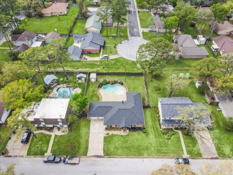
Show pools, outdoor living areas, outbuildings, acreage, driveways, and the relationship between structures.
Add context for parks, lakes, greenbelts, community amenities, major roads, and nearby destinations.
Combine strong ground photography with aerial context so buyers can understand both the home and its setting.
Aerial media for different properties
Residential, commercial, land, and video applications each benefit from a flight plan designed around what buyers need to understand.
Ideal for subdivision homes, corner properties, pools, acreage, estates, scenic surroundings, and properties near parks, lakes, or greenbelts.
Provides an overview of buildings, parking, access points, land, and surrounding development for commercial marketing and evaluation.
Smooth aerial movement adds scale and cinematic context to listing videos, websites, presentations, and social-media marketing.
Professional capture and delivery
A focused aerial set designed to explain the property clearly and work across MLS, web, social, and print marketing.
A focused set of exterior aerial images for properties up to five acres.
Coverage is planned to show the property clearly from useful heights and directions.
Images show how the home, lot, structures, outdoor spaces, and access points relate.
When useful, wider views provide context for amenities, green space, water, and nearby development.
Finished images receive clean, natural editing appropriate for MLS and online marketing.
Files are prepared for MLS, property websites, social media, presentations, and print use.
Flights are planned and captured by a licensed pilot in accordance with current airspace and safety requirements.
Edited aerial photographs are delivered by the next day so listing marketing can move forward.
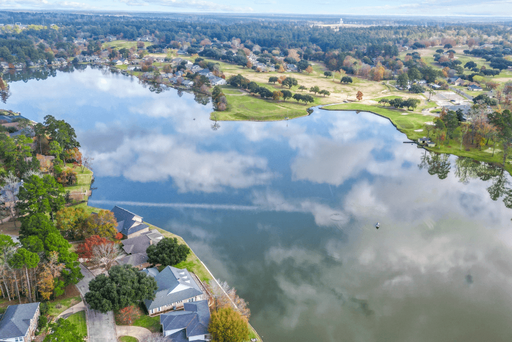
Use aerials when the property's setting is part of the story.
Choose aerials strategically
Give buyers a clear view of lot size, placement, boundaries, and how the home occupies the property.
Show nearby natural features and amenities that are difficult to communicate from the street.
Clarify driveways, entrances, parking areas, road frontage, and relationships between buildings.
Add a polished overview that complements premium interior and exterior photography.
Connect the property to neighborhood landscaping, amenities, trails, water, and the surrounding lifestyle.
Picture This Property aerial work
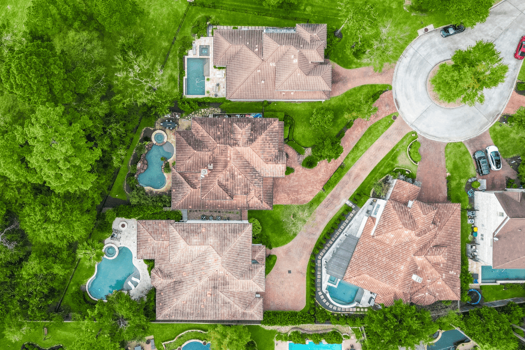
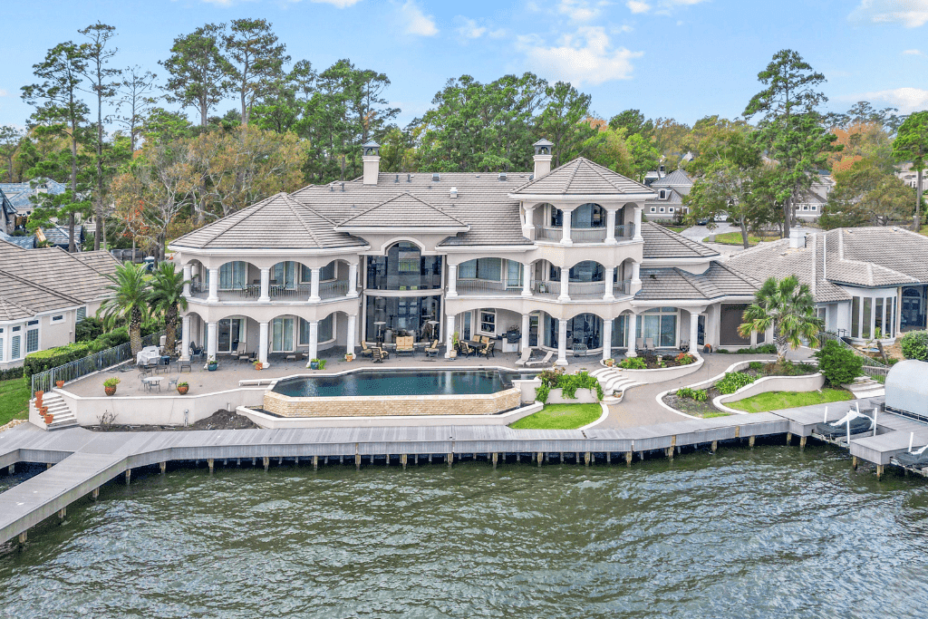
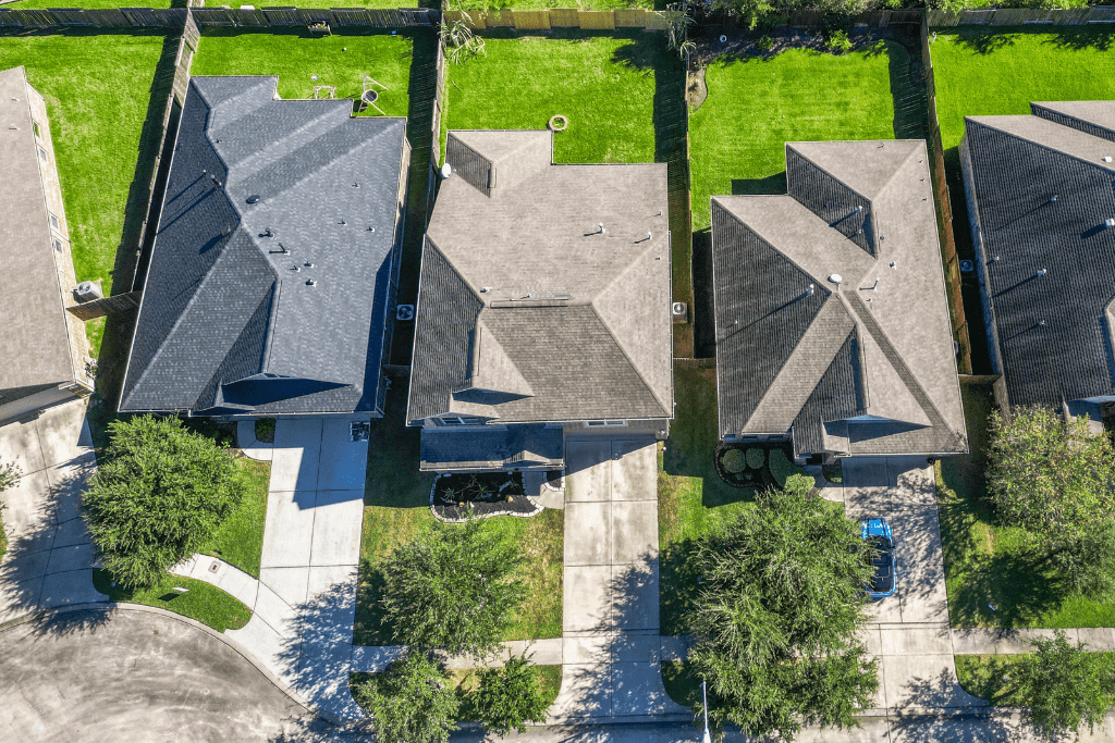
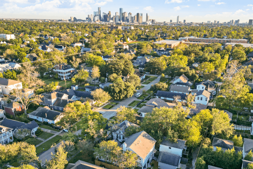
Property placement, outdoor features, waterfront views, neighborhood surroundings, and nearby amenities captured from useful aerial perspectives.
Clear A la Carte pricing
Each A la Carte aerial photography appointment includes five professionally edited exterior aerial photos. Acreage pricing reflects the additional flight planning and coverage required.
Additional aerial photographs are available for $10 per image. Aerial videography starts at $200 for properties up to five acres.
Add aerial context to a complete listing media appointment.
From $325
Compare Bundle PricesBundle includes
Customize the aerial set
Add context, marketing assets, twilight presentation, wider views, or more angles when they improve the listing story.
$35
Property websites, social and printable assets, automated videos, and listing analytics.
$25
Up to five aerial or ground photos of useful amenities or landmarks within five miles.
$25 per photo
Add an approximate property boundary to an aerial image for clearer lot context.
$15 per photo
Transform an exterior or aerial image into a realistic twilight presentation.
$10 per photo
Add more edited aerial angles beyond the five images included in the appointment.
$50
A wide aerial view that helps buyers understand location, scale, and the surrounding environment.
Safe, planned, and ready to market
Book online with the property address and the aerial services needed. Airspace and weather conditions are reviewed before flight.
The licensed pilot photographs the property from multiple useful angles and elevations while following FAA and site-safety requirements.
Edited aerial photographs arrive the next day, organized and ready for MLS, websites, social media, and print marketing.
Complete the listing presentation
Aerial photography establishes setting and scale. These services help buyers understand the rooms, layout, and experience of the home.
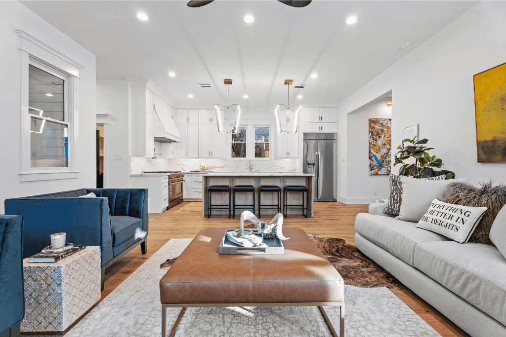
Pair the aerial overview with bright interior and exterior HDR photography plus an included floor plan.
Explore service →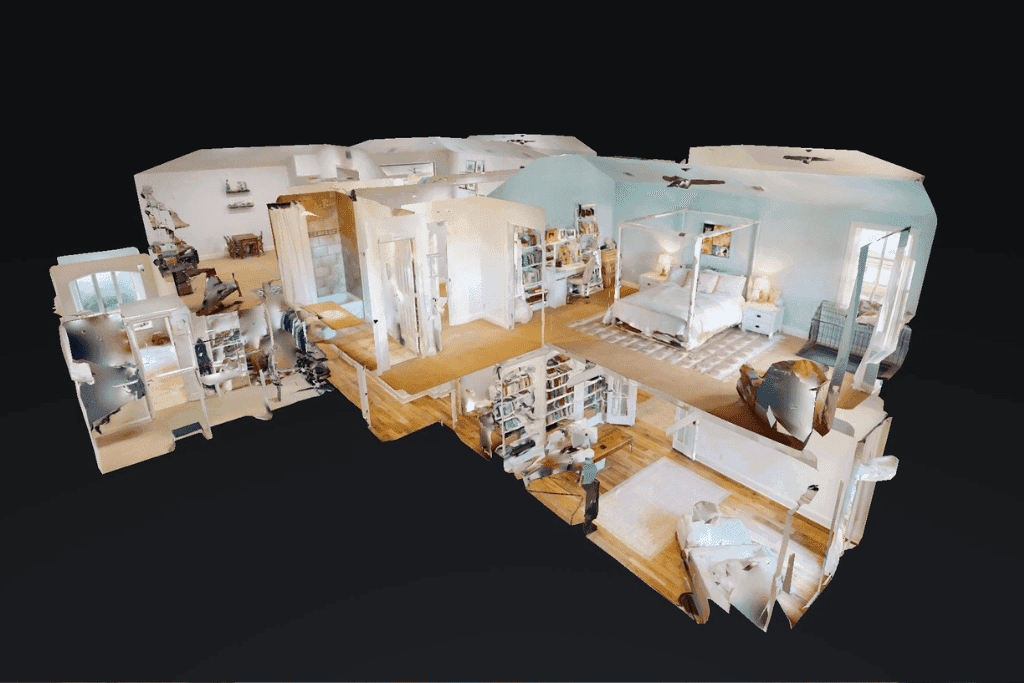
Let online buyers explore the interior after aerial imagery establishes the property's setting and scale.
Explore service →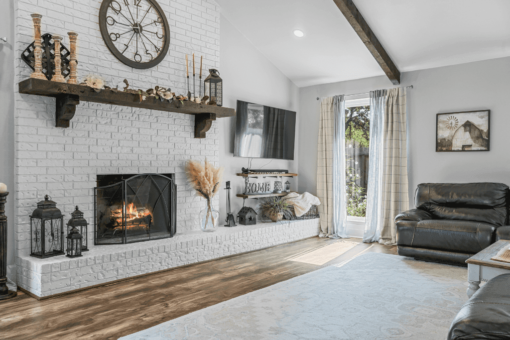
Combine interior walkthrough footage with aerial movement for a more complete property story.
Explore service →Helpful Realtor resources
Practical guidance that helps agents prepare the property, choose the right media, and use the finished assets effectively.
See which property features and listing situations benefit most from an aerial perspective.
Read the guideUse a room-by-room preparation guide before the photographer arrives.
Read the guideUse new visual angles and marketing assets when a listing needs renewed attention.
Read the guideWhat clients say
Real feedback from clients who count on Picture This Property to help their listings stand out.
“Robert did an amazing job on our marketing and photography of our home. His work is very professional and he is easy to work with. Would highly recommend!”
“Robert and his team were able to get my listing photos done in a very timely fashion and they came out amazing. My client and I are thoroughly impressed.”
“I've worked with Robert on two listings, and the results speak for themselves. Clean, crisp, professional shots, fast turnaround, and communication was on point.”
Helpful answers
Common questions about FAA compliance, weather, airspace, pricing, photo quantity, and aerial delivery.
Aerial photography shows property scale, lot layout, outdoor features, access points, neighborhood context, and nearby amenities that ground-level photography cannot fully communicate.
Yes. Aerial media is captured by a licensed pilot and planned around current FAA rules, airspace restrictions, weather, and site conditions.
Most residential aerial appointments take approximately 30 minutes to one hour. Timing varies with acreage, the number of requested angles, airspace requirements, weather, and the complexity of the property.
Wind, rain, low visibility, and other conditions can prevent a safe or useful flight. If conditions are not suitable, the aerial portion will need to be rescheduled for an appropriate weather window.
Yes. Properties near airports, military facilities, restricted airspace, temporary flight restrictions, or other controlled areas may have limitations. Airspace is checked before the appointment, and available options depend on the location.
The standard A la Carte aerial photography appointment includes five professionally edited exterior aerial photographs for properties up to five acres. Additional aerial photos are available for $10 each.
Edited aerial photographs are delivered by the next day. Turnaround for aerial video or other specialty media is confirmed when booking.
Yes, when the aerial perspective provides useful context. Corner lots, pools, greenbelts, nearby parks, cul-de-sacs, community amenities, and unusual lot layouts can all benefit from a well-planned aerial view.
Your next listing starts here
Book your Houston-area real estate photography session online in minutes, or call us for help choosing the right media package.